The Philippines are an archipelagic country in southeast Asia, bordered to the east by the Philippine Sea (western Pacific Ocean), and to the west by the South China Sea. It is composed of roughly 7,640 islands, mostly within volcanic arcs created by oceanic plates to east and west subducting beneath the intermediate Philippine Mobile Belt microplate. The region is extremely active tectonically, both with earthquakes and volcanoes. It extends about 300,000 km2/120,000 mi2 (a little less than New Mexico), with a population of roughly 109 million people.

Southeast Asia and the Philippines.

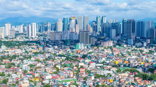
Manila, capital of the Philippines.
The islands received the name “Philppines” from Spanish explorer Ruy López de Villalobos, who named them after King (at the time Prince) Philip II of Spain. The Philippine islands contain some of the oldest proto-human fossils known, including homo luzonensis (est. 67-50 KYA) and Tabon Man (47 KYA). Austronesians arrived between 2200-2000 BCE, and by 1000 BCE had developed several distinct societies.
Map showing the magmatic (volcanic) arcs composing the islands, and the marine trenches to either side.
Cross-sectional view of the Philippines system looking north, with subduction to east and west, and Philippines microplate in the center.
The Spanish began colonizing the area in 1565 and fought to retain control through the late 1800’s, when the First Philippine Republic declared its independence from Spain in 1898 and Spain ceded control to the United States after the Spanish-American War. The Americans imposed a colonial government which remained in place until the Japanese invaded during World War II. Following the war, the Treaty of Manila made US recognition of Philippine independence official.
Some smaller Philippine islands.
Tomorrow: the Philippines and climate change.
Be brave, and be well.


No comments:
Post a Comment